2eimages.co.uk - btphoto.co.uk
![]() 2E
Images & Brian Tuohey Photography
2E
Images & Brian Tuohey Photography
2eimages.co.uk - btphoto.co.uk
![]()
|
Contents Page Birchwood Index History Encounter Pestfurlong Sunrise Risley Moss Risley ROF Walled Garden Bunkers Business Parks Hotel Warrington Rd Autumn Images Winter Christmas Carnival Wildflowers Changes
All photographs on these
pages are the property of Brian Tuohey unless otherwise stated. |
Birchwood's
Walled Garden In 1973 | In 1983 | In 1993 | Today (Google)
Aerial views of the Walled Garden and surrounding area taken in 1973, 83 and 93, as part of aerial surveys of Cheshire. All images from the survey are subject to copyright. Copyright was transferred in April 2009 from the former Cheshire County Council to Cheshire West & Chester Council & Cheshire East Council. Specific details are shown alongside each image. I have also embedded a modern version courtesy of Google Maps for comparison.
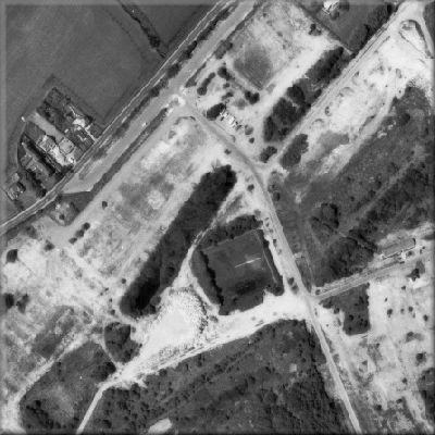
In 1973
This was in the final days of the remains of the former Risley Royal Ordnance Factory. Demolition of the site had already begun in preparation for developing the area into Birchwood. On the photo, the main road is Warrington Road, the buildings to the north are the former almshouses and Roberts Fold, the lay-by at the Oakwood Gate entrance can still be seen, but all of the entrance buildings have been demolished. The dark area immediately north west of the reservoir is an area of mature trees that had existed since the days of the pre-war farms. It still exists today, although less distinct as more recently planted trees have now matured to enlarge the woodland.
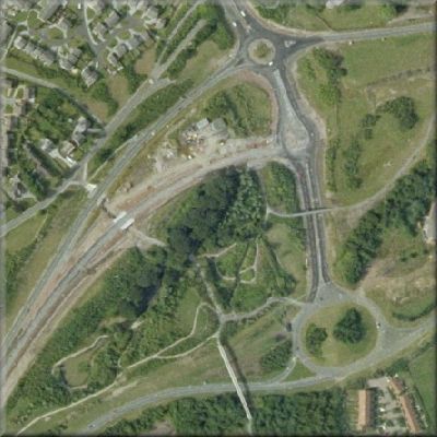
In 1983
By 1983, people were living in Birchwood. Much of Oakwood and Locking Stumps had been completed although building in Gorse Covert was only just beginning. This picture shows that the Walled Garden had been laid out, but the plants were only just becoming established. The "dog-bone" roundabout, now named after Warrington cricketer George Duckworth, was only partly complete, the northern part still being used as a normal roundabout. One section of the westbound carriageway of Birchwood Way was under construction, and the strip of mature woodland mentioned above can clearly be seen.
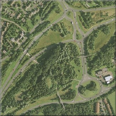
In 1993
By 1993, the area was beginning to look more like the Birchwood of today. The petrol filling station and garage had been built, this part of Birchwood Way was complete and the trees had become much more established, to the extent that it is becoming more difficult to pick out the Walled Garden.
The Area Today
|
||||||||
|
Updated 11/10/11 |
|