2E
Images & Brian Tuohey Photography
2E
Images & Brian Tuohey Photography2eimages.co.uk - btphoto.co.uk
2E
Images & Brian Tuohey Photography
2eimages.co.uk - btphoto.co.uk
![]()
|
Contents Page Moelfre Index Gallery 1 Gallery 2 Gallery 3 Gallery 4 Gallery 5 Gallery 6 Gallery 7 Lifeboat Day 2006 Lifeboat Day 2007 Lifeboat Day 2008 Lifeboat Day 2009 Lifeboat Day 2010 Lifeboat Day 2011 Lifeboat Day 2012 Links All photographs on these
pages are the property of Brian Tuohey unless otherwise stated. |
Moelfre,
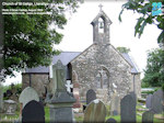
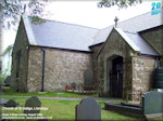
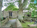
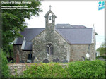
Anglesey Church of St Gallgo, Llanallgo
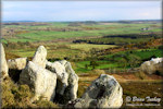
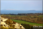
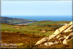
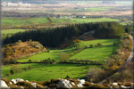
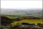
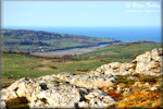
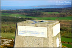
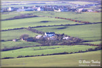
The church of St Gallgo is situated next to the main road between Moelfre and Dulas, about a quarter of a mile after the Moelfre roundabout. It is the main church within the parish and it has a rich history, details of which can be found on the church's website www.royalcharterchurch.org.uk. The website also gives a clue to what the church is perhaps best known for. In its grounds is a memorial to the victims of the Royal Charter tragedy in 1859. In total about 450 lives were lost and 140 of those who died are buried at St Gallgo's. Also specially commemorated is the rector at the time of the tragedy, Stephen Roose Hughes, who worked tirelessly to help the families of those who perished. The church also has personal significance to me, because my grandparents who died in the 1970s are buried there. Mynydd Bodafon At 178m above sea level, Bodafon is the highest point on the
main island of Anglesey. Holyhead Mountain (Mynydd Caergybi or Mynydd Twr), on Holy Island
the only point in the Anglesey area that is
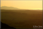
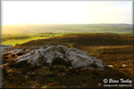
higher. From the summit of Bodafon, there are uninterrupted views
across much of the island and beyond to the mountains of Snowdonia. On a
clear day it is possible to see as far as England, Scotland, Ireland and
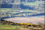
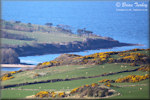
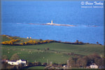
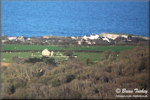
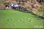
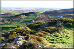
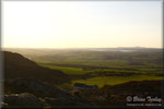
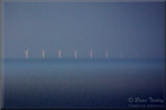
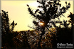
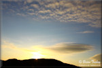
the Isle of Man! Bodafon is located a few miles inland, west of Moelfre and south west of Dulas Bay. The pictures were taken on a late afternoon walk to the top of Bodafon at the end of March 2012. The views are in various directions, taken from the summit or very close by. Several include views of Dulas Bay and there is one of Dulas Island (#12). Another (#13) shows Ynys Moelfre and Hen Capel Lligwy. #17 shows Puffin Island and the lighthouse at Penmon Point. I hesitated about whether to include #18, but decided to do so even though it looks poorer quality. The wind turbines are off the North Wales coast near Rhyl and they had only just come into view as the visibility improved during the hour in which we were there. My camera was on maximum zoom and the photo is cropped, but even through the haze, they looked slightly pink with the setting sun behind us as each one faded further into obscurity. #19 is in the opposite direction showing Holyhead Mountain and I think that might be an Irish Sea ferry in the picture too. |
|
Updated 07/03/13 |
|