2E
Images & Brian Tuohey Photography
2E
Images & Brian Tuohey Photography2eimages.co.uk - btphoto.co.uk
2E
Images & Brian Tuohey Photography
2eimages.co.uk - btphoto.co.uk
![]()
|
Contents Page Moelfre Index Gallery 1 Gallery 2 Gallery 3 Gallery 4 Gallery 5 Gallery 6 Gallery 7 Lifeboat Day 2006 Lifeboat Day 2007 Lifeboat Day 2008 Lifeboat Day 2009 Lifeboat Day 2010 Lifeboat Day 2011 Lifeboat Day 2012 Links All photographs on these
pages are the property of Brian Tuohey unless otherwise stated. |
Moelfre,
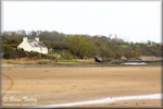
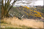
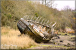
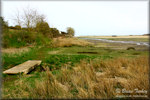
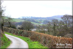
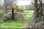
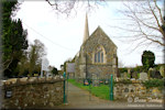
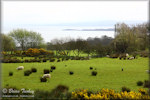
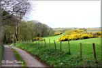
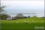
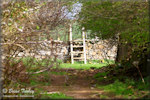
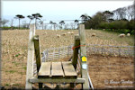
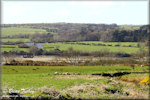
Anglesey Dulas Walk | Ynys Dulas | Other Images Dulas Walk These photos were all taken on a springtime walk in 2012 on the Isle of Anglesey Coastal Path on the north side of the big inlet at Traeth Dulas, which I'm told is known locally as The Lagoon. There are two wrecks of old wooden boats in The Lagoon, one in the middle and the other at the edge by one of the cottages. We drove down the narrow single track lane and parked where the lane ended. There are some parking places along the edge of the tarmac, but I wouldn't like to leave the car there if we were expecting a high tide. After a short distance along the beach, our route turned off alongside a white cottage, and took us up a winding lane past one of the lodges of the Llysdulas estate, a privately owned stately home, then to a stone church dedicated to St Gwenllwyfo. On the map it looked little more than half a mile, but we found this section quite strenuous. Shortly after, the path turned off the lane and took us across a field of sheep and their lambs before joining another lane. This led us past the top of the Llysdulas estate and through some of its woodland. We hadn't expected to see what looked like an old military car gradually rusting away half buried under vegetation. Shortly after passing a farm, the road turned left and the path continued ahead over a stile. By now the land to the right had opened up and we could see Dulas Island below. Another stile took us into a colourful field with the bright yellow flowers of gorse all around us. We were planning to go all the way down to the sea, which would have been the closest point on land to Ynys Dulas, but at the next stile we decided to turn back.
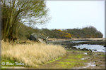
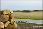
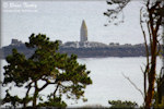
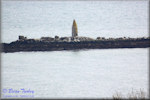
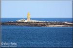
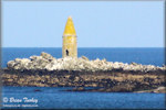
Ynys Dulas North of Dulas Bay and about 1 kilometre offshore lies Ynys Dulas. Ynys Dulas is deserted except for its population of grey seals and it is popularly known as Seal Island. It also has a tower which is believed to have been built by a wealthy local family for shipwrecked mariners in the days of sailing ships and was kept stocked with food and drink for them. The first three photos below were taken on the walk described above. The 4th photo was taken from Traeth yr Ora and the same photo has been more tightly cropped for the 5th image.
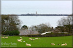
Other Images The first is looking across Dulas Lagoon from the land above Traeth yr Ora. The wrecked boat in the middle of the lagoon can be seen, and on the right is the spire of St Gwenllwyfo's Church. As for the other photos, I couldn't resist snapping some photos of lambs.
|
|
Updated 07/03/13 |
|